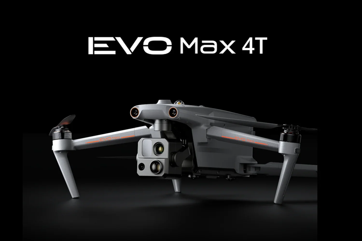
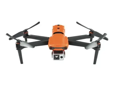
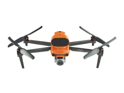
Autel EVO Max 4T Redefines Enterprise Drone Autonomy with 720° Obstacle Avoidance
Robot Details
EVO Max 4T • Autel RoboticsPublished
February 5, 2026
Reading Time
3 min read
Author
Origin Of Bots Editorial Team
Next-Generation Autonomy Arrives
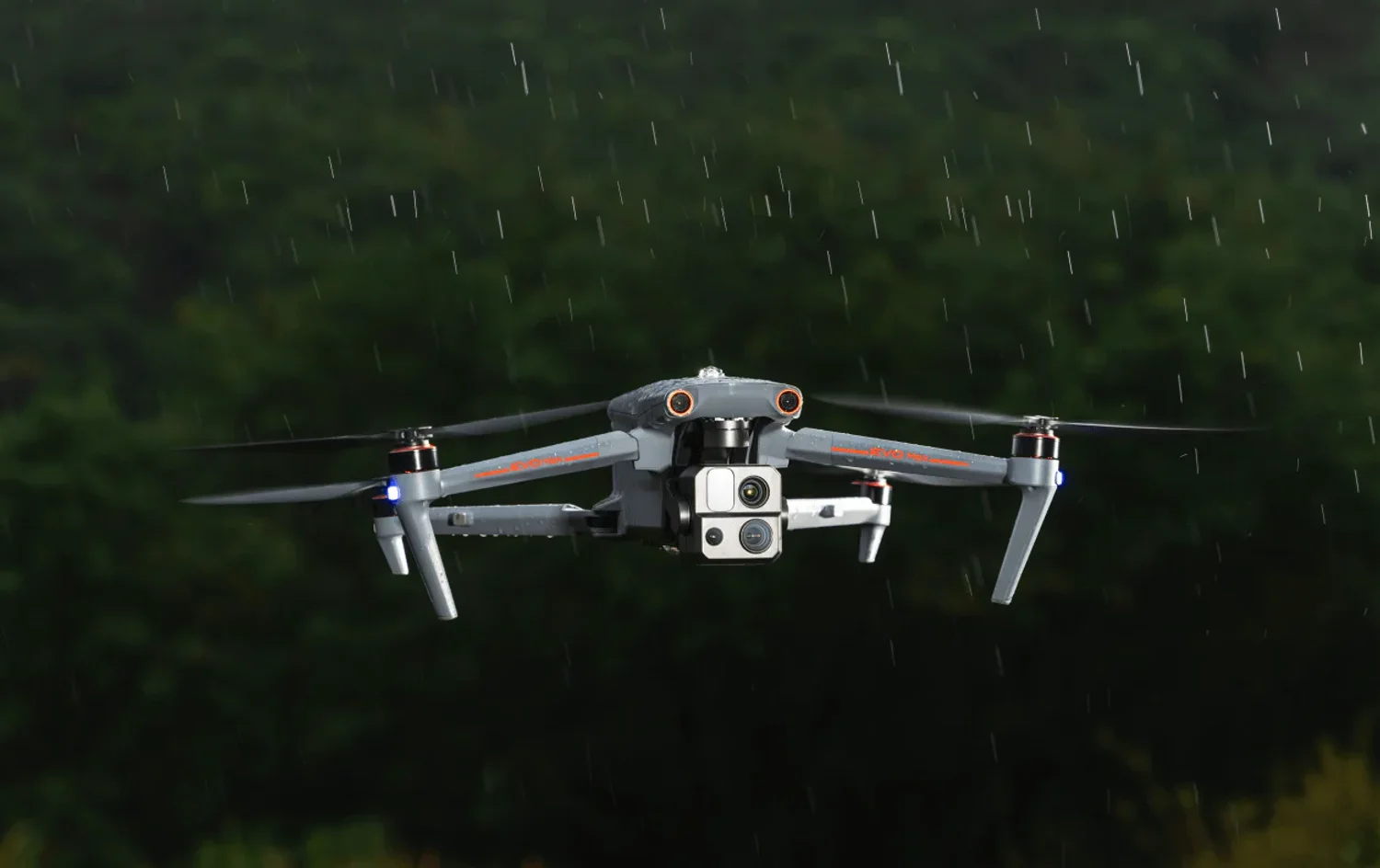
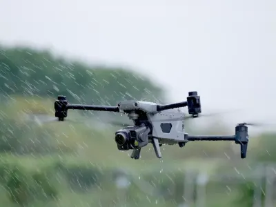
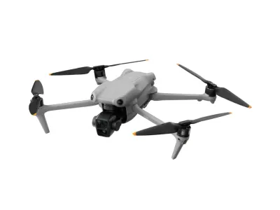
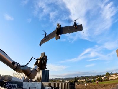
Autel Robotics has unveiled the EVO Max 4T, an enterprise-grade drone that fundamentally reshapes how unmanned systems navigate complex environments. The platform introduces industry-first millimeter-wave radar technology paired with binocular vision systems, enabling the drone to construct real-time 3D flight paths and execute autonomous operations in GPS-denied zones. This represents a watershed moment for industrial inspection, public safety, and search-and-rescue missions where traditional navigation fails.
Sensor Architecture Breakthrough
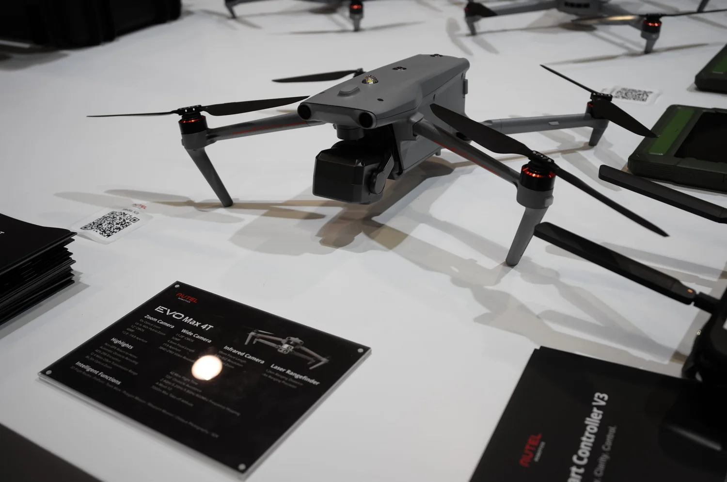
The EVO Max 4T's sensor ecosystem transcends conventional drone design. Integrated wide, zoom, and thermal cameras work in concert with a laser rangefinder and advanced ultrasonic array, creating a perception system that rivals manned aircraft in environmental awareness. The millimeter-wave radar operates independently of lighting conditions and weather, detecting obstacles at distances where optical sensors become unreliable. This redundancy transforms the drone from a fair-weather tool into an all-conditions asset capable of night operations and adverse weather scenarios that previously demanded human pilots.
Mesh Networking Unleashed
Autel's A-Mesh 1.0 technology enables drone-to-drone autonomous communication and collaboration, marking the industry's first mesh networking capability for unmanned systems. The Autel SkyLink 3.0 transmission backbone incorporates six antennas across four frequency bands with AES-256 encryption and optional 4G integration, delivering a 12.4-mile transmission range. This architecture allows coordinated multi-drone operations without manual intervention, fundamentally expanding deployment possibilities for large-scale infrastructure assessment and emergency response scenarios.
Real-World Impact Across Industries
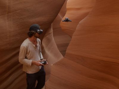
Industrial inspection teams leverage the EVO Max 4T's thermal and zoom capabilities to assess power infrastructure, wind turbines, and cellular towers without deploying personnel to hazardous heights. Search-and-rescue operations benefit from extended flight endurance and navigation in GPS-denied environments like dense forests or urban canyons. Surveying and mapping professionals utilize the drone's 3D map planning and visual odometry to generate precise datasets in challenging terrain, while public safety agencies deploy it for disaster assessment and perimeter monitoring where rapid situational awareness determines operational success.
Key Specifications & Performance
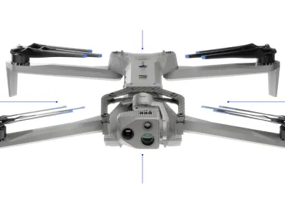
The EVO Max 4T weighs 1.6 kilograms in flight-ready configuration and folds to 257 x 145 x 131 millimeters for transport, balancing portability with enterprise payload capacity. Maximum speed reaches 23 meters per second, enabling rapid response deployment. The platform achieves approximately 42 minutes of flight time under operational conditions, sufficient for comprehensive site surveys without mid-mission battery swaps. Integrated navigation combines visual odometry, SLAM algorithms, and multi-constellation GNSS (GPS, GLONASS, Galileo, BeiDou, NavIC, QZSS) to maintain positioning accuracy across diverse geographical and environmental contexts. Safety systems include 720° obstacle avoidance, anti-jam transmission protocols, automatic return-to-home functionality, and low-battery warnings that prevent operational surprises.
Competitive Positioning Analysis
| Robot | Strengths over EVO Max 4T | EVO Max 4T Advantages | Weaknesses vs. EVO Max 4T |
|---|---|---|---|
| EVO II Dual 640T V3 | Proven thermal stability in legacy deployments | Millimeter-wave radar, mesh networking, superior 3D autonomy | Older sensor architecture, limited autonomous capabilities |
| ANAFI Ai | Lighter weight for portable operations | 720° obstacle avoidance, extended range (12.4 mi), thermal+zoom integration | Single-band transmission, reduced autonomous coordination |
| IZI Spectra Drone Camera 4K | Lower acquisition cost for budget deployments | Advanced thermal suite, enterprise-grade encryption, multi-constellation GNSS | Limited obstacle detection, shorter transmission range |
| IZI Mini X Nano Fly More Combo 4K Drone | Extreme portability for casual operations | Industrial-grade autonomy, 4G integration option, A-Mesh collaboration | Consumer-grade sensors, minimal environmental awareness |
Sources
Related Articles
Parrot ANAFI Ai Masters GNSS-Denied Zones with AI
Autel EVO II Dual 640T V3 Deploys 45 Seconds with 640x512 Thermal
Autel EVO II Pro V3 Masters Night Shoots with Moonlight 2.0
Autel Dragonfish Pro Masters Ship Landings in 2025 Upgrade
Related Comparisons
Compare EVO Max 4T with similar robots
DJI Air 3 vs DJI Air 3S
Compare DJI Air 3 vs DJI Air 3S for camera quality, low-light sensors, obstacle avoidance, battery life, and pro videography outcomes.
DJI Avata 3 vs DJI Neo 2
Which camera drone is better? DJI Avata 3 vs DJI Neo 2 compared for image quality, battery life, range, safety, and pro vs beginner use.

Skydio X2D vs Skydio X10
Compare Skydio X2D vs Skydio X10 for camera quality, flight time, range, and cinematic capabilities in defense and inspection.
Skydio F10 vs Skydio X2D
Compare Skydio F10 vs Skydio X2D for camera quality, flight range, obstacle avoidance, and professional surveillance performance.
Learn More About This Robot
Discover detailed specifications, reviews, and comparisons for EVO Max 4T.
View Robot Details →