RNZAF Base Ohakea Deploys Skydio X10 for Security and Airfield Operations
Robot Details
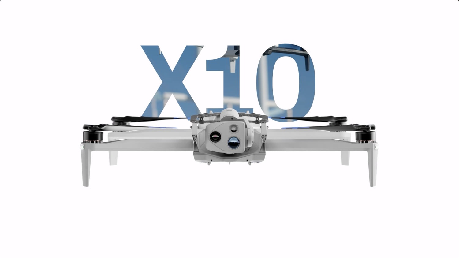
Skydio X10 • SkydioPublished
March 12, 2026
Reading Time
3 min read
Author
Origin Of Bots Editorial Team
Ohakea Pioneers Drone Defense
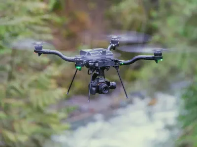
New Zealand's Royal New Zealand Air Force at Base Ohakea integrates the Skydio X10 into daily security patrols and airfield monitoring, marking a strategic shift toward autonomous aerial oversight in early 2026 trials. This deployment enhances perimeter surveillance across the vast base, enabling rapid threat detection amid rising regional tensions. Personnel report quicker response times to intrusions, with the quadcopter's folding design allowing one-operator launches from mobile units. Such adoption demonstrates how military bases worldwide now rely on AI-driven drones to safeguard critical infrastructure without constant human presence.
Autonomy Redefines Patrols
Skydio X10 disrupts traditional security by autonomously tracking suspects or vehicles through cluttered airfields, using NightSense for zero-light operations that pierce total darkness. Operators at Ohakea praise its track-in-place mode, which locks onto targets mid-flight even as they maneuver evasively. Powered by Skydio Autonomy AI on a Linux base, the drone processes visuals in real time, reducing pilot workload during extended sweeps. This capability transforms routine airfield checks into proactive defenses, where the system anticipates hazards before they escalate.
Sensors Pierce Darkness
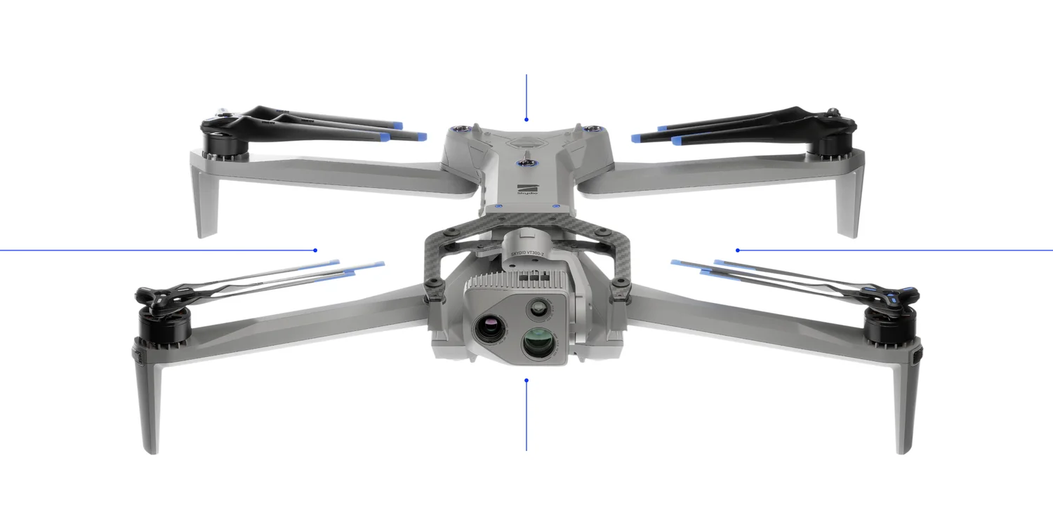
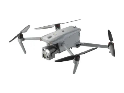
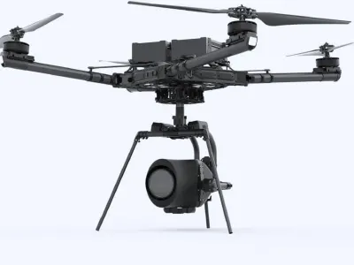
Engineering feats shine in the X10's sensor array, including a 640x512 FLIR Boson+ thermal camera that spots heat signatures from afar, vital for Ohakea night ops. LiDAR and six 32MP navigation cameras fuel Visual Inertial Odometry and SLAM, ensuring precise positioning amid GNSS disruptions common near runways. NVIDIA Jetson Orin processing handles these inputs seamlessly, enabling 360-degree obstacle avoidance up to 20 meters. These advances allow safe flights in gusts to 12.8 m/s, outperforming manual drones in adverse Kiwi weather.
Airfield Missions Evolve
Public safety teams at Ohakea deploy X10 for search-and-rescue simulations and infrastructure scans, inspecting hangars for defects via 50MP wide-angle and 64MP narrow cameras. In defense scenarios, it maps runways post-storm, relaying live feeds over 12 km via Connect SL. Surveying overgrown perimeters becomes effortless, with modular payloads up to 500g swapping for speakers in crowd control. This versatility extends to partner agencies, showcasing how droneCamera tech bolsters airfield readiness without grounding aircraft.
Specs Fuel Missions
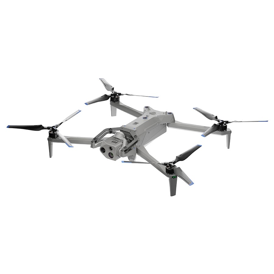
Weighing 2.11 kg in Connect SL config up to 2.49 kg max takeoff, the X10 folds to 35.0 x 16.5 x 11.9 cm for easy Ohakea transport, unfolding to 79.0 x 65.0 x 14.5 cm with props. It hits 20 m/s (45 mph) speeds, with batteries enduring 300+ cycles for repeated airfield runs. Sensors like 50MP 1" CMOS wide, 64MP narrow, thermal, LiDAR, and RTK GNSS pair with VIO, SLAM, and NightSense for flawless navigation. Safety includes 360° avoidance and low-battery returns, while quadcopter mobility supports public safety to defense uses.
Rivals Faceoff
| Robot | Key Advantage | Where Skydio X10 Wins | Target Use |
|---|---|---|---|
| Skydio X2D | Proven autonomy legacy | Superior thermal resolution and LiDAR | Legacy inspections |
| DJI Inspire 3 | Cinematic 8K video | Folding portability and NightSense | Film production |
| EVO Max 4N | Long-range cellular | 360° avoidance in zero light | Remote surveying |
| ANAFI Ai | Lightweight foldable design | Heavier payload and faster speeds | Tactical defense |
Related Articles
DJI Matrice 350 RTK Dominates Recent Enterprise Trials
DJI Matrice 300 RTK Expands Battery Ecosystem with TB65 Upgrade Path
XTI Aerospace Adds Alta X Gen2 with 35lb Payload, NDAA February 2026
Astro Max Doubles Payload to 3kg with 60% Thrust Boost
Related Comparisons
Compare Skydio X10 with similar robots

Skydio X2D vs Skydio X10
Compare Skydio X2D vs Skydio X10 for camera quality, flight time, range, and cinematic capabilities in defense and inspection.
Skydio F10 vs Skydio X10
Skydio F10 or Skydio X10? Compare for surveillance endurance, high-res cameras, thermal imaging, range, and professional inspection reliability.

Skydio R10 vs Skydio X10
Head-to-head: Skydio R10 vs Skydio X10 compared on sensor size, obstacle avoidance, low-light performance, and real-world indoor vs outdoor flight reliability.
Skydio F10 vs Skydio X2D
Compare Skydio F10 vs Skydio X2D for camera quality, flight range, obstacle avoidance, and professional surveillance performance.
Learn More About This Robot
Discover detailed specifications, reviews, and comparisons for Skydio X10.
View Robot Details →