WingtraRAY
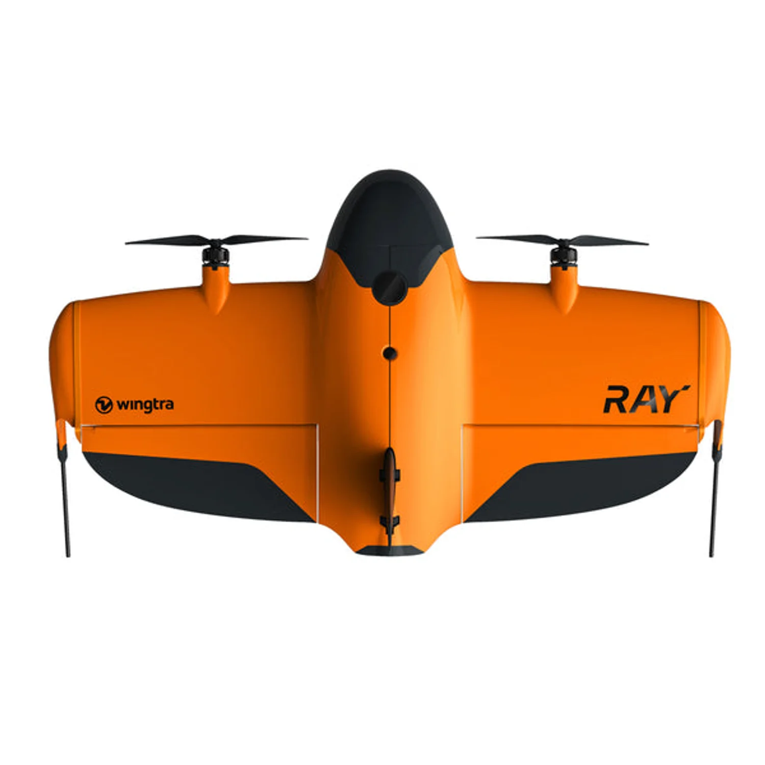
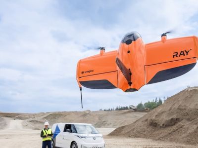
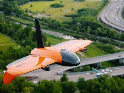
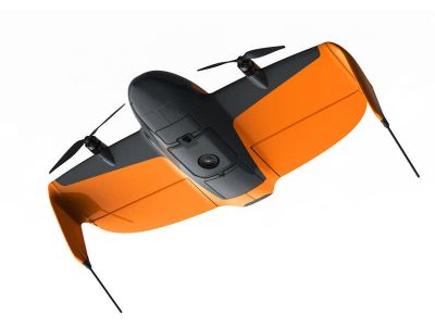
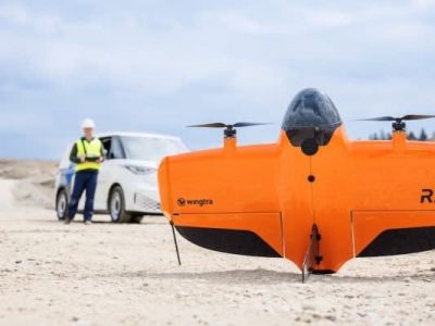
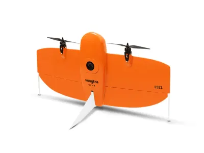
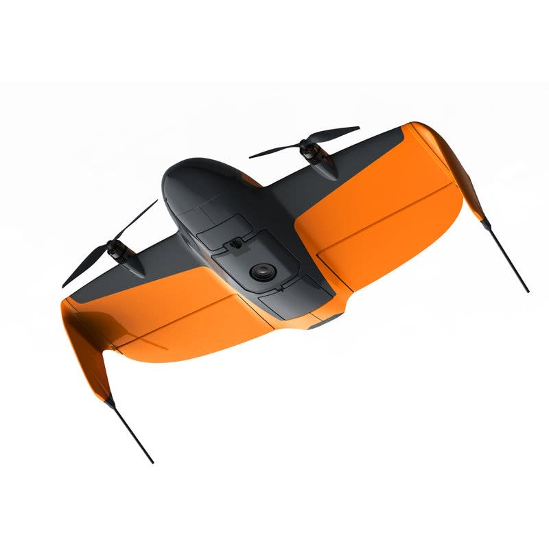
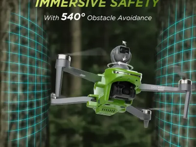
The WingtraRAY is a modular tailsitter VTOL survey drone engineered for high-precision mapping and surveying tasks. Featuring vertical takeoff and landing, it deploys from confined spaces without runways, achieving adaptive cruise speeds of 16-22 m/s for efficient coverage up to 550 ha per flight at 120 m altitude with the MAP61 sensor. With a 59-minute max flight time for RGB/multispectral payloads and 45 minutes for LiDAR, it supports tool-less payload swaps in under 30 seconds, including 61 MP RGB, multispectral, and LiDAR options. PPK GNSS ensures centimeter-grade accuracy without GCPs, while IP53 weather resistance and certified parachute enhance safety. Ideal for large-scale topography, agriculture, and infrastructure inspection, its fixed-wing efficiency combined with modular design delivers survey-grade results faster than competitors.
Image Gallery
Below images are from Wingtra's official sources
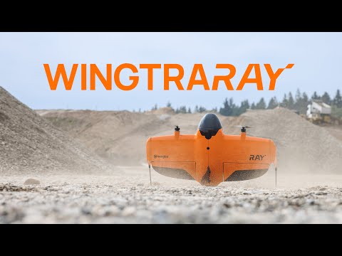
Review Videos
Watch expert reviews and demonstrations of this robot

More Robots from Wingtra
Explore other robots from this manufacturer
Latest News About WingtraRAY
Stay updated with the latest articles and developments
WingtraRAY Achieves FAA Category 3 Approval for Over-People Flights
WingtraRAY secures FAA Category 3 certification for operations over people, eliminating waiver needs across 98 percent of U.S. territory thanks to its certified parachute system. This approval, highlighted in recent deployments as of July 2025, transforms drone surveying by enabling safer, faster missions near crowds or infrastructure without regulatory hurdles. Surveyors now deploy in urban zones or busy sites, slashing downtime and boosting efficiency for time-sensitive projects like emergency response mapping.
More Drones
Discover more robots in the same category


Robots From Other Categories
Discover complementary robots from different categories that work well together


Frequently Asked Questions
Get answers to common questions about this robot
Q1. What is WingtraRAY, and what problem is it designed to solve?
WingtraRAY is a tail-sitter VTOL drone developed by Wingtra for aerial surveying and mapping. According to the manufacturer, it addresses challenges in capturing large-area data quickly and accurately in varied environments, including urban and remote sites.
Q2. What are the main capabilities and key features of WingtraRAY?
WingtraRAY supports modular sensors for RGB photogrammetry, multispectral imaging, and LIDAR, with vertical takeoff transitioning to fixed-wing cruise flight. The manufacturer states it enables operations over people with an optional parachute add-on for regulatory compliance.
Q3. Who is WingtraRAY built for, and which industries can benefit from it?
WingtraRAY targets surveyors and professionals in mapping. Industries including construction, agriculture, urban planning, and environmental monitoring can use it for tasks like volumetrics, plant health analysis, and terrain modeling, per company descriptions.
Q4. Is WingtraRAY a commercial product or still a research prototype?
WingtraRAY is a commercial product offered by Wingtra through distributors. It features survey-grade sensors and workflows optimized for professional applications rather than research prototyping.
Q5. Is WingtraRAY currently available for purchase, and when is it expected to ship?
As of 2026, WingtraRAY is available for purchase via authorized distributors. Shipping follows pre-order fulfillment, with LTE connectivity noted as available in 2026 subject to regional variations.
Q6. How does WingtraRAY actually work in real-world environments?
WingtraRAY takes off vertically on its tail, transitions to forward fixed-wing flight for efficiency, and adapts speed to maintain image overlap amid wind or terrain changes. It supports PPK for accuracy in workflows over populated or vegetated areas.
Q7. When was WingtraRAY announced or officially launched?
Wingtra announced WingtraRAY in 2025, with promotional videos released that July. The manufacturer positioned it for commercial surveying deployments starting in 2026.
Q8. How is WingtraRAY different from other robots in the same category?
Unlike multirotor drones, WingtraRAY uses VTOL with fixed-wing cruise for extended coverage and efficiency. The company emphasizes its tight sensor integration tuned specifically for surveying outputs over general-purpose designs.
Q9. Does WingtraRAY require additional development or customization after purchase?
WingtraRAY features tool-free modular swaps for batteries and payloads, enabling field reconfiguration without airframe changes. According to Wingtra, it integrates with existing GNSS ecosystems for end-to-end surveying workflows.
Q10. What is the future roadmap or planned upgrades for WingtraRAY?
Wingtra has announced plans to expand sensor options and regional LTE availability in 2026. The company targets broader compliance certifications and workflow enhancements for diverse surveying applications.
User Comments (No Login needed)
Share your thoughts, experiences, or questions about this robot.
Comments are reviewed before posting.