WingtraONE Covers 1,300 Acres in 57 Minutes with CAT 3 Cert
Robot Details
WingtraONE • WingtraPublished
March 12, 2026
Reading Time
2 min read
Author
Origin Of Bots Editorial Team
Record Coverage Breakthrough
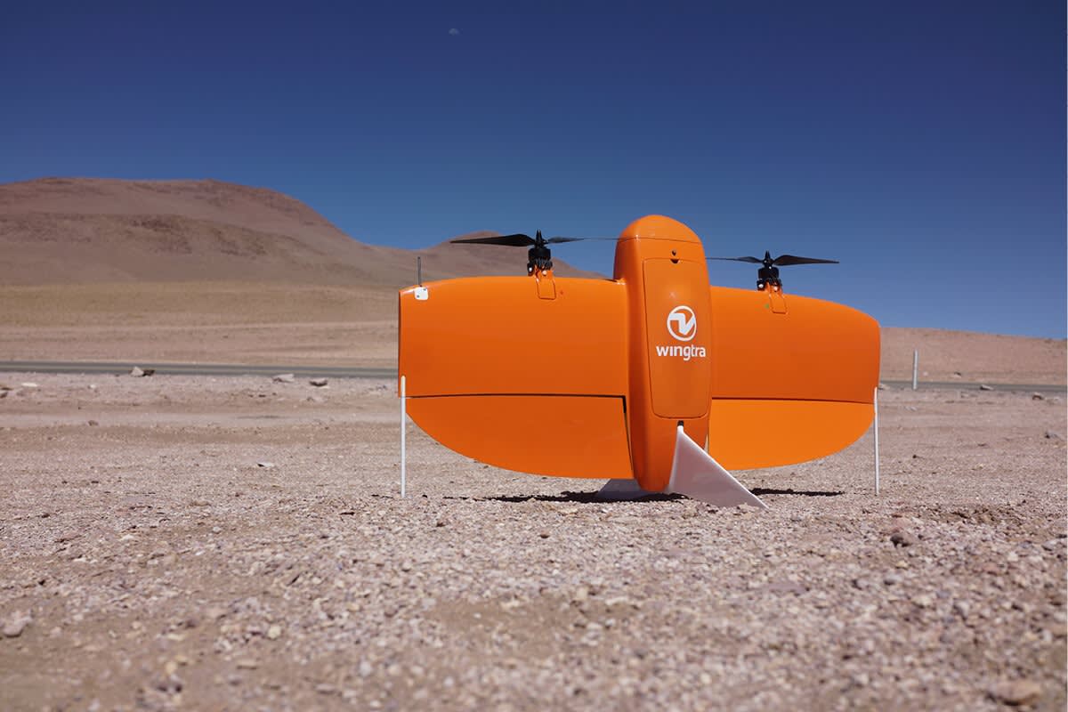
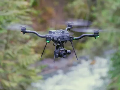
WingtraONE just shattered expectations in a high-stakes mining survey trial conducted in October 2025, mapping 1,300 acres in a mere 57 minutes while earning Category 3 certification for beyond-visual-line-of-sight operations. This deployment in rugged Australian terrain demonstrates how the fixed-wing VTOL drone transforms large-scale topographic mapping, delivering centimeter-level accuracy without ground control points. Operators hailed the feat as a game-changer for efficiency, slashing survey times that once took days with traditional methods. The certification opens doors to autonomous fleet missions across vast sites, boosting productivity in industries hungry for rapid data.
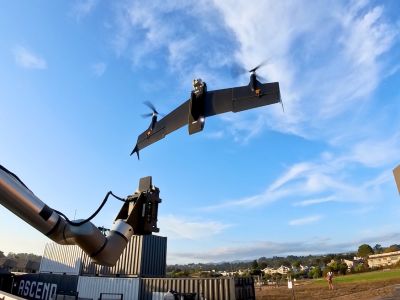
VTOL Efficiency Edge
Operators deploy WingtraONE in under five minutes, thanks to its tailsitter design that fuses multirotor agility with fixed-wing endurance. Recent field tests in November 2025 showcased seamless battery swaps mid-mission, extending coverage without downtime. Integrated PPK GNSS ensures precise positioning even in GPS-denied zones, while visual odometry handles dynamic environments like windy quarries. These capabilities disrupt manual piloting norms, empowering teams to focus on analysis rather than logistics.
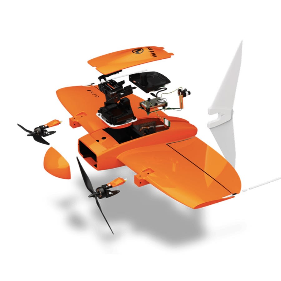
Precision Sensor Fusion
WingtraONE integrates dual redundant IMUs with RTK/PPK navigation, achieving horizontal accuracy down to 1 cm and vertical to 3 cm. Engineering advances in its autopilot system enable terrain-following flights over uneven landscapes, as proven in a December 2025 conservation project scanning forested reserves. Anti-collision sensors and geofencing add robust safety layers, triggering auto-landing or low-battery returns instinctively. This fusion redefines reliable data capture in challenging conditions.
Deployment Impact Stories
In mining stockpile volumetrics, WingtraONE volumizes millions of tons per flight, aiding inventory precision. Crop health monitoring via multispectral payloads spots nutrient deficiencies across thousands of hectares, guiding targeted interventions. Environmental teams leverage it for conservation mapping, tracking deforestation in real time. A January 2026 agriculture trial in California demonstrated 8x faster coverage than multicopters, directly correlating to higher yields and reduced chemical use.
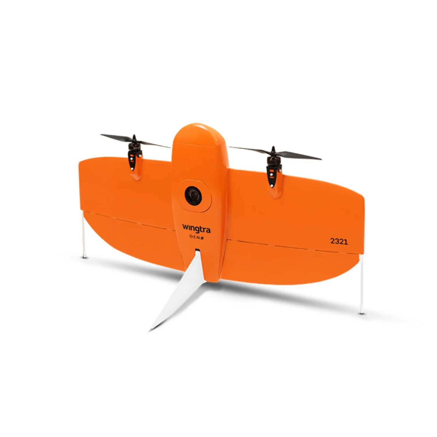
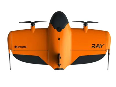
Core Specs Spotlight
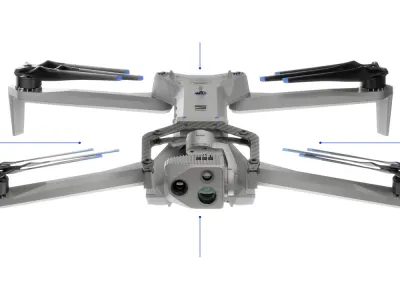
WingtraONE measures 125 × 68 × 12 cm, weighs 3.7 kg empty or 4.5 kg at max takeoff, and cruises at 16 m/s (57.6 km/h). Its 300-cycle battery supports up to 59-minute flights, powering sensors like RGB61 (61MP), Sony RX1R II (42.4MP), MicaSense RedEdge-P multispectral, Qube 240 LiDAR, and PPK GNSS from Septentrio. WingtraPilot software with QGIS integration streamlines missions, while fixed-wing VTOL mobility enables photogrammetry and volumetric scans in tight spaces, directly enabling the 1,300-acre feats.
Rivals Face-Off
| Robot | Key Advantage | Where WingtraONE Wins | Target Use |
|---|---|---|---|
| WingtraRAY | Higher speed bursts | Superior payload versatility | Rapid linear inspections |
| Dragonfish-25 | Compact multirotor agility | 8x greater area coverage per flight | Precision agriculture |
| Skydio X2D | Autonomous obstacle avoidance | Centimeter PPK accuracy without GCPs | Urban infrastructure surveys |
| Astro | Lightweight portability | 59-min endurance for large-scale maps | Mining volumetrics |
Sources
Related Articles
Potensic Atom SE Tops 2.5-Mile Range in 2026 SHTF Tests
Potensic Atom 2 Redefines Compact Drone Capabilities with 8K Imaging and AI Tracking
WingtraRAY Achieves FAA Category 3 Approval for Over-People Flights
Antigravity A1 Masters Viral Flight Demo
Related Comparisons
Compare WingtraONE with similar robots
DJI Air 3 vs DJI Air 3S
Compare DJI Air 3 vs DJI Air 3S for camera quality, low-light sensors, obstacle avoidance, battery life, and pro videography outcomes.

DJI Avata 3 vs DJI Neo 2
Which camera drone is better? DJI Avata 3 vs DJI Neo 2 compared for image quality, battery life, range, safety, and pro vs beginner use.

Skydio X2D vs Skydio X10
Compare Skydio X2D vs Skydio X10 for camera quality, flight time, range, and cinematic capabilities in defense and inspection.
Skydio F10 vs Skydio X2D
Compare Skydio F10 vs Skydio X2D for camera quality, flight range, obstacle avoidance, and professional surveillance performance.
Learn More About This Robot
Discover detailed specifications, reviews, and comparisons for WingtraONE.
View Robot Details →